Everything AstroLina can do
Your birth chart, drawn onto the world. Every line, every technique, every tool — and what each one is for.
Open the map — it's free New to astrocartography? Start here
Chapter oneThe map
One canvas in three registers — flat, globe, and the sky that draws them — and everything you do to move around on it.
Interactive world map
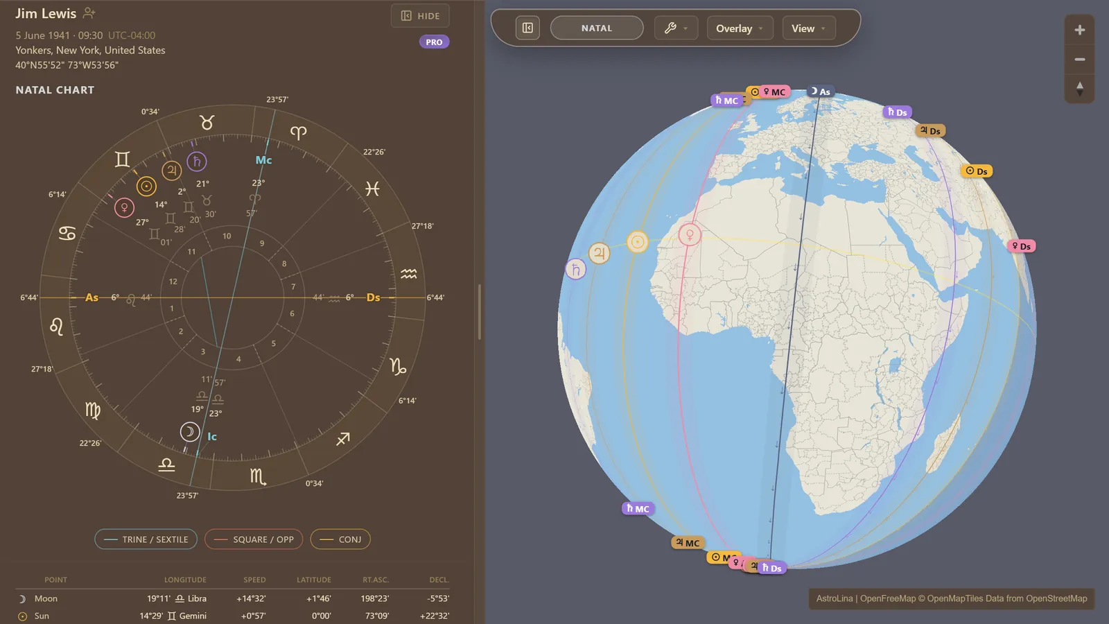
The same chart and the same lines on a classic Web-Mercator map or a rotatable globe, one keystroke apart, in any browser. Nothing is a preview: change a setting and the whole map re-renders live, with no dialogs standing between you and it. On a phone it behaves the way a map should — pinch to zoom, two fingers to tilt and turn.
Themes and basemap detail
Three basemaps — Dark, Earth and Glass — with separate switches for roads and rivers and for place names, so you can quiet the backdrop when the linework gets dense. Night Shade darkens the half of Earth in night at the moment on display, which is quietly useful when you are watching an overlay sweep across the world.
Pins and live relocation
Double-click drops the pin or moves it; right-click takes it away. Everything downstream follows: the chart wheel, the angles, the readouts. Hovering alone is enough to preview a place, and the status pill tells you which reading you are looking at — natal, hover, pinned, or the natal pin. It is the difference between a map you look at and a map you interrogate.
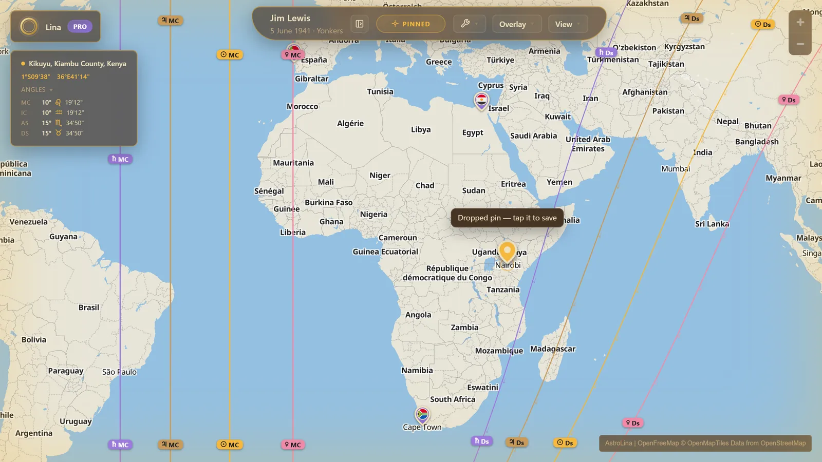
Coordinates
A small window that keeps the live place name, its coordinates, and the relocated Midheaven and Ascendant in view while you move. When you are comparing two places a degree apart, this is the readout that settles it.
Teleport
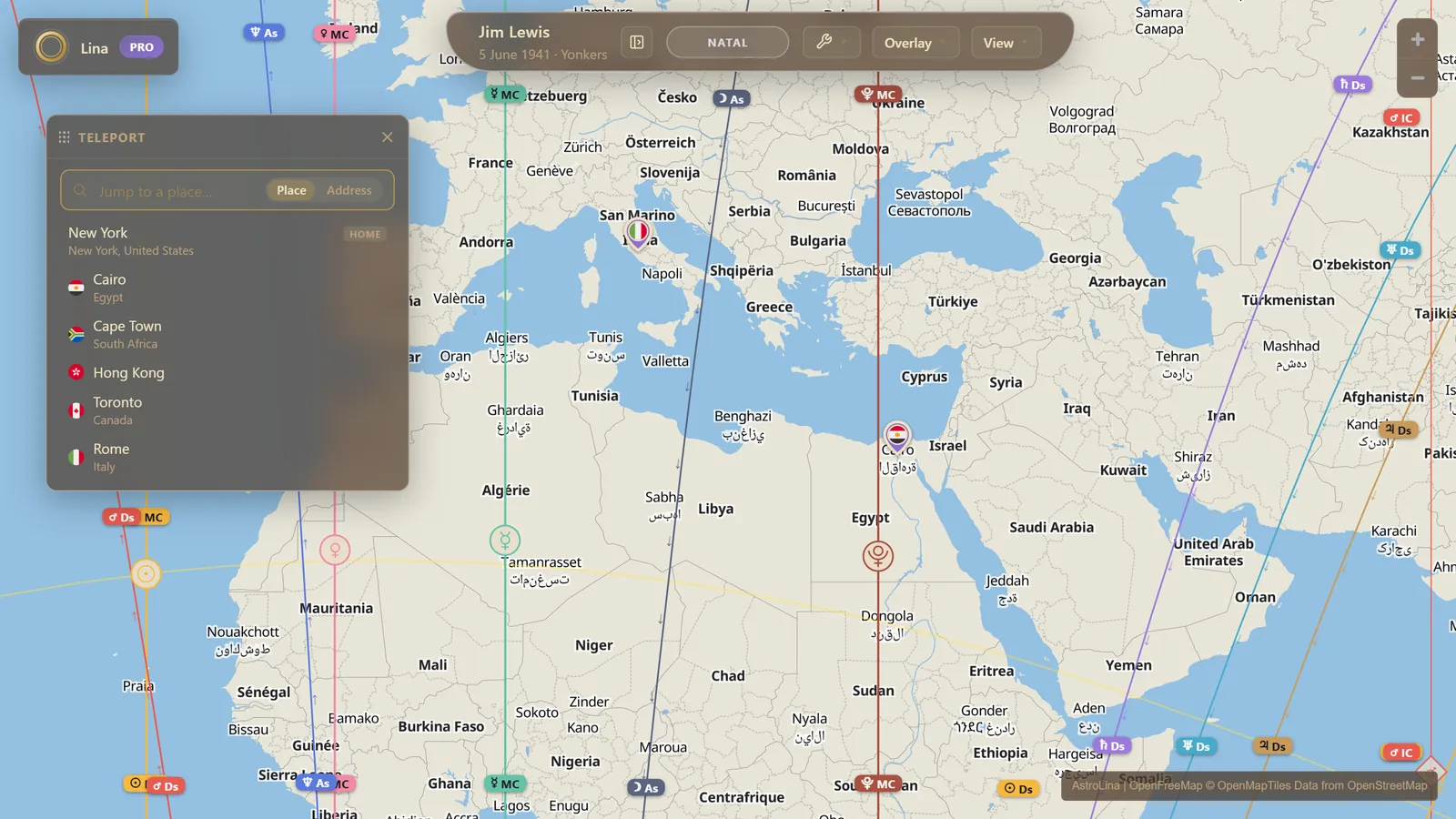
Search any place and fly there, zoomed to fit. It reads the same bundled atlas the birthplace field does, so it answers instantly and offline, and it lists the current chart's Home before you have typed anything. With Pro, your saved pins are listed there too.
Saved pins
Drop a pin, tap it, and it stays — purple, flying its country's flag, titled with the nearest city, or Middle of nowhere if you are out at sea. Saved pins then surface by name in every place field in the app, so a pin called "my cool treehouse" comes up the moment you type treehouse. They can be created from the map, from Discovery, from Radar or from the Journal, and deleting one anywhere deletes it everywhere.
Measure
Click and drag for a great-circle distance. Hold Shift while you drag and the far end snaps onto a line, which turns the vague question of am I near it? into a number.
Map filters
Per-body switches in three groups — planets, points, and minor bodies — plus the four angles and an optional Vertex axis. Turn off what you are not reading and the map gets legible again. If a body cannot be drawn under your current calculation settings, its row goes inert with a struck-through name and a line naming the setting to change, and your choice is remembered for when you change it back.
Info chip
A corner chip summarising the conventions the chart is currently running under: line frame, coordinate convention, house system, zodiac, node type. Every value on it is a button that jumps straight to the setting that controls it.
Galaxy
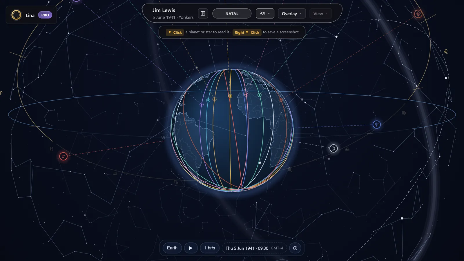
The map's third register. Your astrocartography lines drape over a rotating Earth suspended inside the celestial sphere, with the planets above as glyph coins and a plumb line from each one down to its zenith point — the place on the ground it stands over. Layer in the zodiac, the ecliptic and equator, the horizon, the forty named stars, the eighty-eight constellation figures precessed to your date, and the Milky Way. Its own clock plays at speeds from real time to a week a second, and anything you find there can be pushed back to the map's timeline or jumped to on the map.
Chapter twoThe lines
Every family of line a chart can throw onto the world, and what each one is for.
Planetary lines
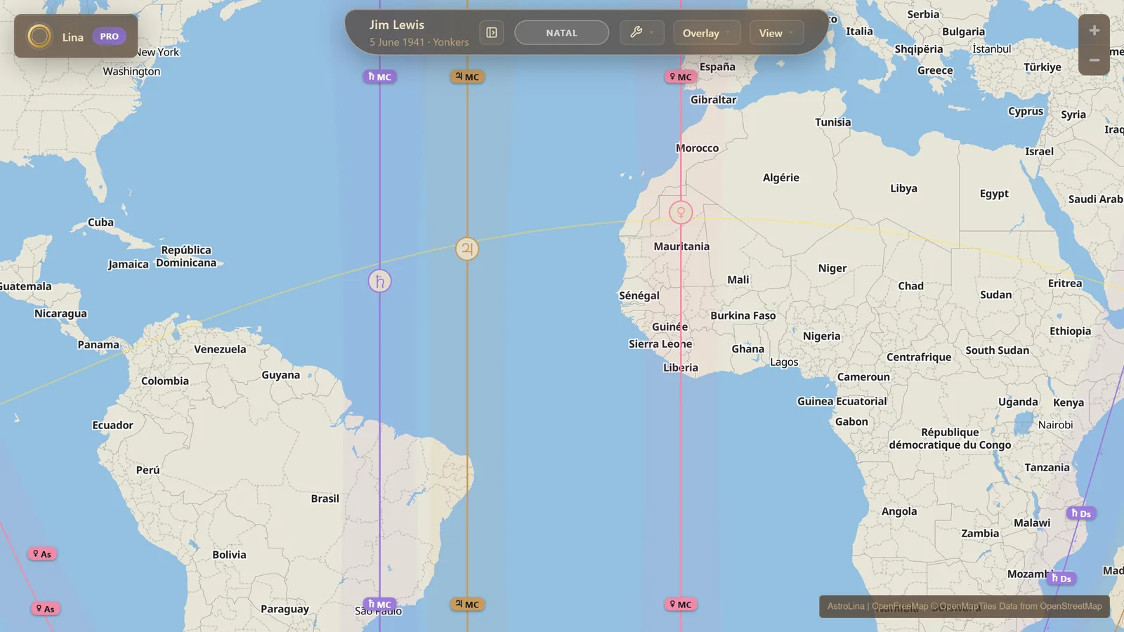
For every body, the line where it stood on one of your chart's main angles at the moment you were born: rising, setting, culminating, or anti-culminating. Nineteen bodies and points are drawn — the seven traditional planets and the three modern ones, the North and South Nodes, Black Moon Lilith, Chiron, Ceres, Pallas, Juno and Vesta, and the Part of Fortune — each colour-coded, each dashed by angle, each tagged with a glyph badge so a crowded map still reads. Lines can be drawn In Mundo or In Zodiaco, celestial or geodetic, as you prefer.
Line reading cards
Click any line and a card explains what that planet on that angle classically means. Every body-and-angle pairing has its own written entry, along with the aspect and fixed-star themes, so the map teaches its own vocabulary as you use it rather than sending you to a book.
Zenith and nadir stamps
A circle marks each body's zenith point on its Midheaven line, and a diamond the nadir directly opposite. Drawn In Mundo that circle is the spot the body genuinely stood overhead; In Zodiaco it marks the sub-point of the body's ecliptic position instead, so that it stays on the In Zodiaco line. Hover to identify one, click to fly there.
Orb zones
A line is read as a band, not a hairline. Shade a stretch of ground either side of each line — in kilometres or miles, adjustable per side — and the map answers am I within range? at a glance instead of by measurement.
Parans
The latitudes where two bodies reach an angle at the same moment — any two angles, in any combination. At that latitude the pair's themes stay braided all the way around the world: a paran is a band of latitude, so on a flat map it runs clean east to west, where a body's Midheaven and Imum Coeli lines run straight north to south and its Ascendant and Descendant lines curve. They are drawn for every planetary pairing your filters allow.
Fixed stars
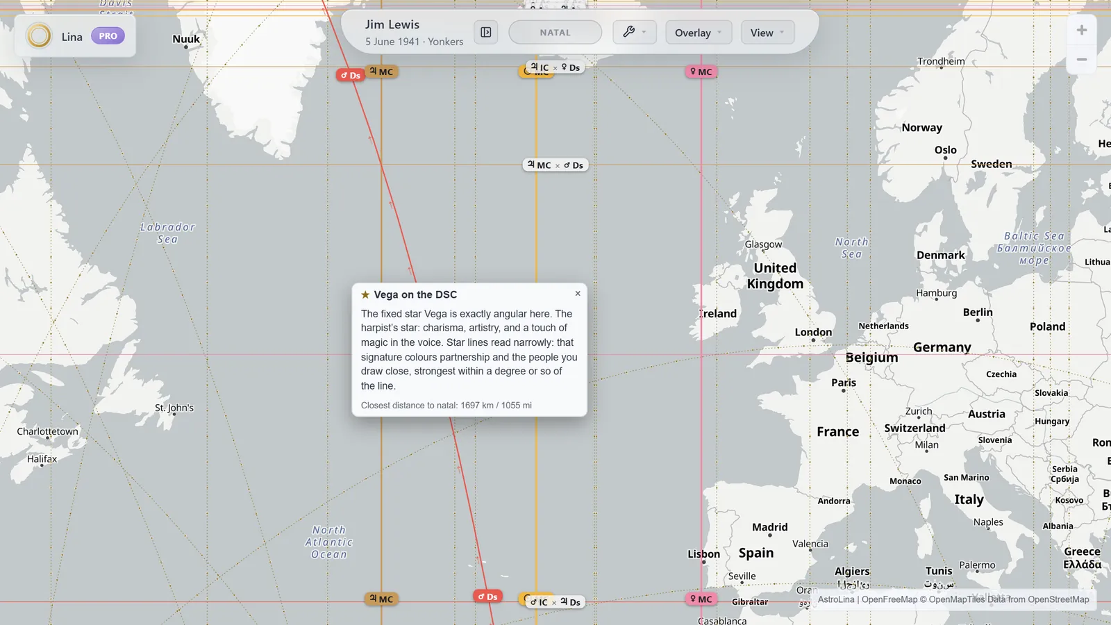
Dotted lines threaded with small stars, in their own starlight tint so they never read as planets. Two sets to choose from: the headline eighteen, which take in the four royal stars and the brightest classics, or the full forty. Rising and setting lines are skipped where a star is circumpolar and never meets the horizon at all — they would be a fiction. Parans are the traditional reading at those latitudes, and the star contacts still surface in Radar and Line Notes, both Pro.
Aspect lines
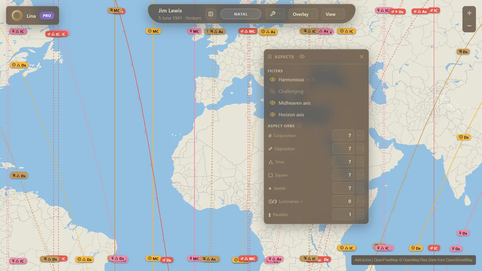
Where a planet stands sextile, square or trine to your angles — each aspect twice, once to each side. The lines themselves take no aspect orb: they mark the exact angle. The aspect orbs you set shape the wheel and its lists instead, while the map judges how near you are to a line by that line class's own orb.
Midpoint lines
Where the midpoint of any two visible bodies sits exactly on an angle. In Mundo gives the bodily midpoint; In Zodiaco gives the classic midpoint in longitude. Filter the bodies down first, or the combinatorics will bury the map.
Aspects
One window for the whole aspect set, opened from the Aspect Lines row in Settings. Filter the map's aspect lines by quality — harmonious or challenging — and by axis — Midheaven or horizon — and set every aspect orb in one place instead of one at a time. It is the difference between drawing all of them and drawing the ones you are reading.
Part of Fortune
The classical Lot, with the sect-based day-and-night formula as the default and the Ptolemaic fixed formula as an option. It is a zodiacal point, so it goes inert In Mundo — and says so, rather than drawing something it cannot justify.
Local Space
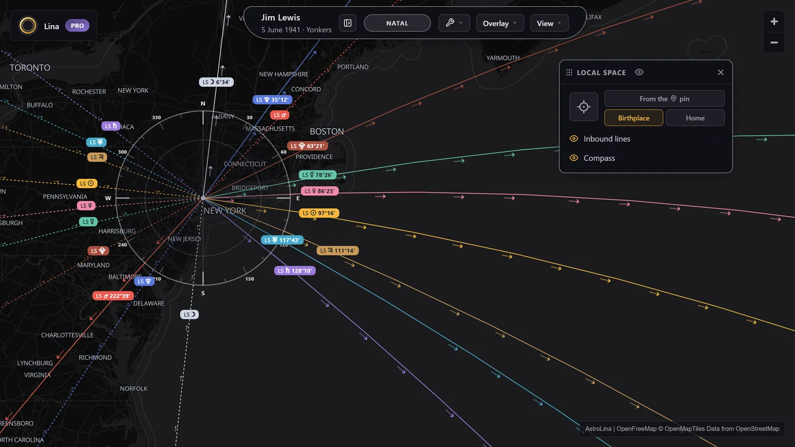
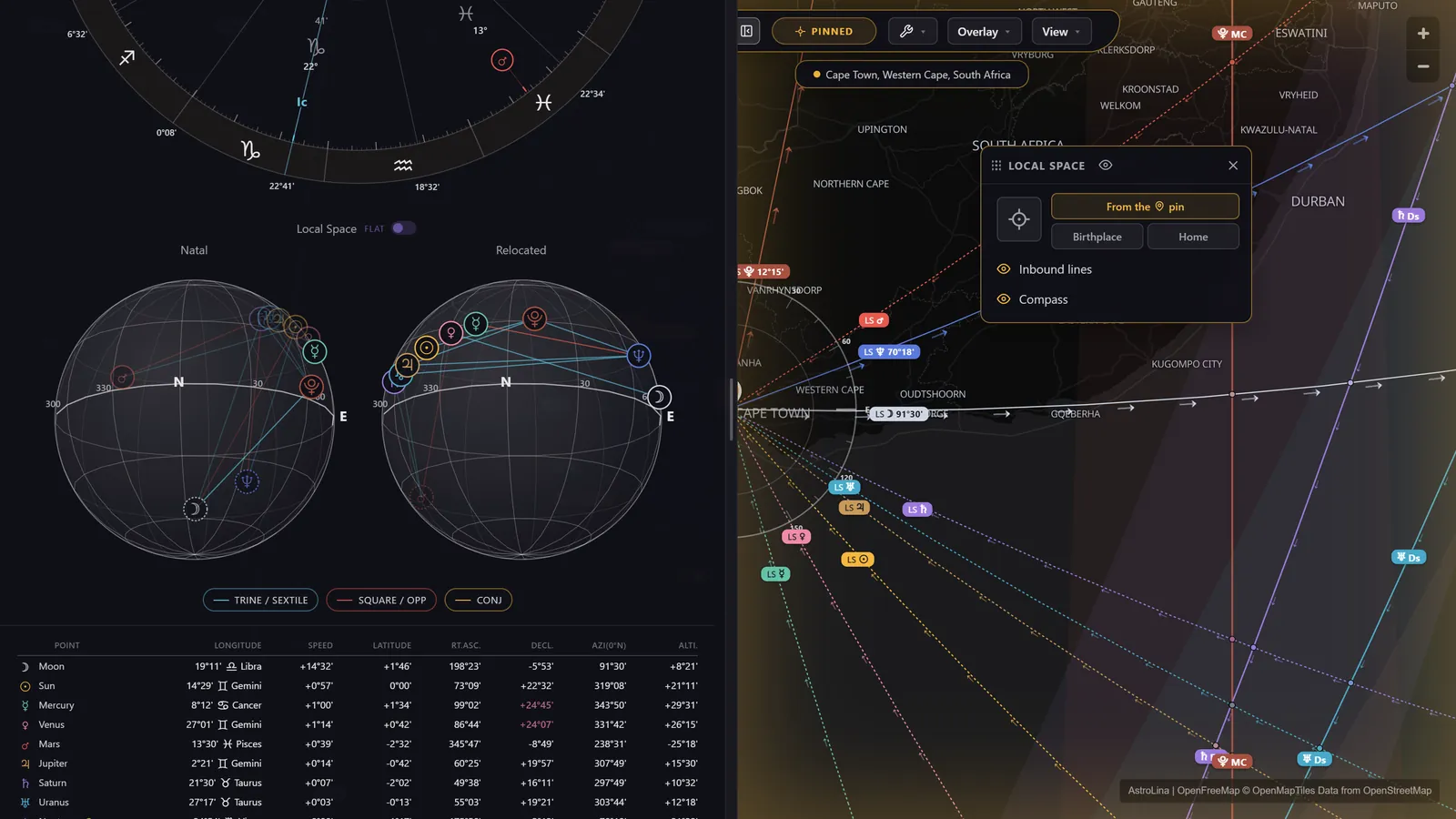
One direction line per body, radiating from your birthplace or from any pin you drop, each running out along that planet's compass bearing and continuing as a great circle through its zenith point. This is the local-space compass: the question it answers is which way, not how far. Optional inbound lines continue the bearing out the other side, and a compass dial lists every azimuth.
Line Notes
One place, read back to you as prose. A lead sentence for the strongest influence, then every line, paran and star contact in range, grouped and ordered by closeness, and a short strip of the next dates each becomes exact there. Distances are given as proximity — on the line, near, within orb — rather than as raw kilometres, and when nothing is in range it says so plainly instead of reaching.
Chapter threeCharts, places and people
The data behind the lines: how a chart gets in, how a place resolves, and how two charts share one map.
My Charts
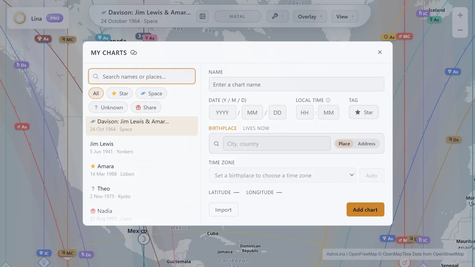
A searchable library of everyone you read for, filtered by name or birthplace and by chips for starred, local-space, unknown-time and shared charts. The top-bar switcher swaps between them; returns to the previous chart, and quick taps cycle your recent five. With a free account the library syncs across your devices.
Adding a chart
Name, date, time and birthplace. The place field resolves as you type and works the time zone out for you, historical daylight saving included, across the years 1800 to 2200.
Unknown birth time
Plenty of people don't know their birth time, and that shouldn't keep them off the map entirely. Save the chart with the time marked unknown and you still get the wheel: every planet by sign and degree, computed for noon. What you won't get is lines, because the angles are what the clock decides, and a guessed time can move them continents. Add the time later, or have an astrologer rectify one, and the map is waiting.
Import charts
Paste an AstroDataBank-style block or a comma-delimited export, or drop a .txt or .csv file in, and bring a whole practice across at once. Imported charts carry their own coordinates and zone offset, so import bypasses the geocoder entirely and the source data stays authoritative.
The place field, everywhere · Address scope
Every place field in the app is the same field: birthplace, Teleport, Radar, the Journal, Reports, Home. It answers from a city atlas bundled into the app — every country and region plus towns above roughly fifteen thousand people — instantly and offline, and reaches for an online gazetteer only for what the atlas does not carry, which is how a bay, a national park or a very small village turns up. With Pro, a second scope switches the same field to real street addresses.
Home
A second place per chart: where that person lives now. It is optional, it drives local-space bearings and — with Pro — Radar's alignment reading, and it never travels in a share link.
Your work follows the chart · saved pins, Journal and Radar
Home belongs to the chart, not to the account — and with Pro, so do saved pins, journal entries and Radar's last scan. Switch charts and the entire working set swaps with it, so reading for someone else never means picking your own places back out of theirs.
Share links
Capture builds a link that reopens the chart, the camera position and the pin exactly as you left them. Opening one adds the chart to the receiver's library tagged as shared, and the first time you make one the app explains plainly what the link carries.
Synastry
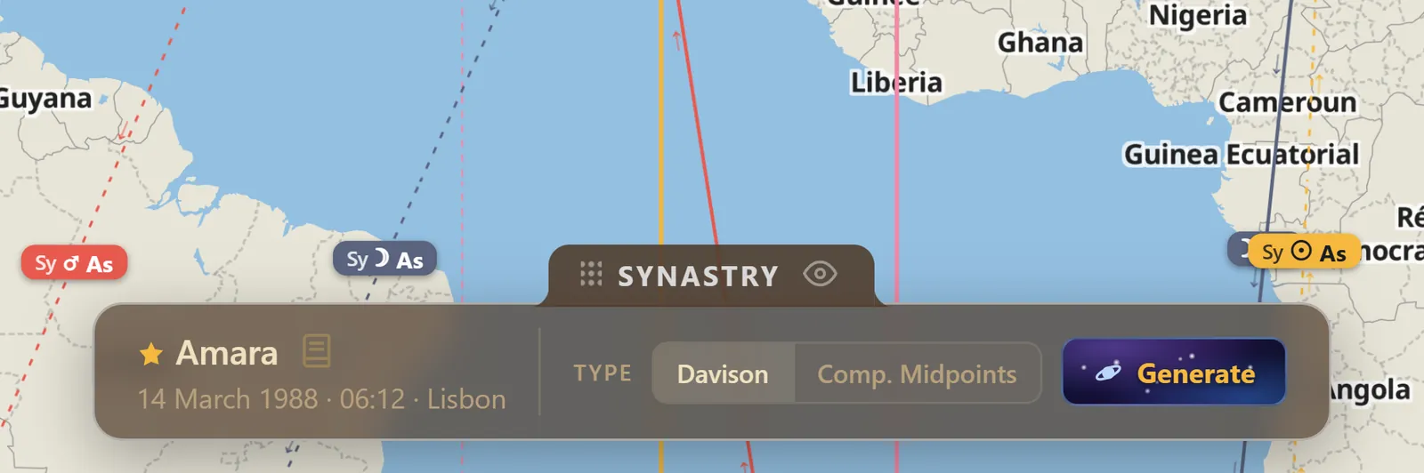
Lay a second person's chart over yours and where should I move? becomes where should we move? Both line-sets draw on one map, with a bi-wheel and the cross-aspects between the two charts. Filter each side down to four or five bodies or it becomes noise.
Composite and Davison charts
Or map the relationship itself. A composite chart takes the shorter-arc midpoints between the two charts and frames the map on its own Midheaven; a Davison is a real chart cast for the midpoint in both time and space. Either one maps like any other chart.
Chapter fourThe wheel
Once the map has narrowed the world to one place, this is how you read that place in depth.
Minimap
The natal wheel kept small in a corner, re-reading at whatever point is active. Enough to keep the chart in the corner of your eye while your attention is on the map.
The expanded wheel
The full chart in a resizable sidebar, with houses and aspects, re-cast for wherever you are pointing. Every window in AstroLina moves — drag to reposition, double-click to dock, collapse to a title nub — and this one is where most of the reading happens.
Positions table
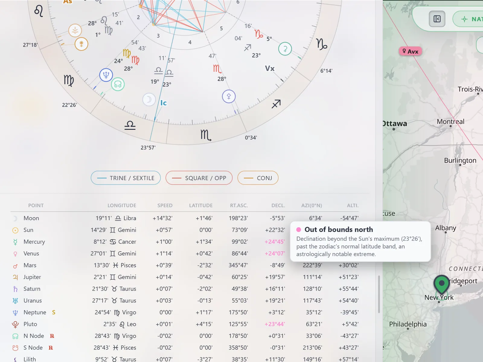
Every body's longitude, speed, latitude, right ascension, declination, azimuth and altitude in one table, with badges for retrograde, stationary and out-of-bounds declination. The declination column is the one most tools bury, and it is the one parans live in.
Three aspect frames
Zodiacal aspects with per-aspect orbs, declination parallels and contraparallels, and — with Local Space running — the azimuth aspects between compass bearings. Three genuinely different geometries, not three views of one.
Compare
The pair-by-pair table that sets a chart's natal aspects against its local-space ones and tells you what happened to each: retained, changed, lost, or new. Sortable, filterable by status, and the fastest answer there is to what does relocating actually do to this chart?
Balance and dignities
Element and modality tallies, and each body's essential dignity or debility — rulership and exaltation, detriment and fall — alongside the wheel.
Local Space dials
A pair of rotatable horizon globes side by side, one for the birthplace and one for wherever you have relocated to, placing every body by compass bearing and altitude. They are the same moment seen from two horizons, with a shared camera and linked hover, and they can be flipped to flat two-dimensional compasses if you prefer to read them that way.
House systems, zodiac and orbs
Ten house systems — Placidus, Koch, Regiomontanus, Campanus, Porphyry, Alcabitus, Meridian, Morinus, Whole Sign and Equal — each with a line explaining what it does. Tropical or sidereal by the Lahiri or Fagan/Bradley ayanamsa. Per-aspect orbs, a widener for the luminaries, and a separate orb for declination parallels. Above the polar circles, where quadrant systems like Placidus become undefined, the wheel falls back to Porphyry — which trisects the arcs between the angles and stays well-defined at any latitude — and tells you it has. None of this moves the map: a line marks where a body was physically angular, which no house system and no ayanamsa can shift. Change either and the wheel, the degrees and the dignities are recast; the lines stay exactly where they are.
Chapter fiveTime
The same map with a date on it — and the lists that say when, exactly.
Time overlays
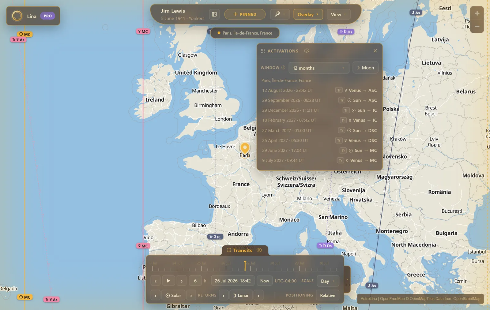
Scrub the date and a second, dated set of lines sweeps the map beside your natal ones. A place that is quiet today can carry a Jupiter line next spring, and this is where you find out. Seven techniques ship, and the overlay menu cycles them:
- Transits — where the planets are now, over your natal chart.
- Sec. Progressed — secondary progressions, the symbolic day-for-a-year unfolding.
- Tert. Progressed — tertiary progressions, a day for a lunar month, for finer timing.
- Solar Arc — every point advanced by the Sun's roughly one-degree-per-year arc.
- Primary Directions — the sky's own daily rotation read as a life-clock, turning the whole line-set westward at a chosen rate per year: Ptolemy, Naibod, Cardan, solar daily motion in right ascension or longitude, true solar arc, or a rate you set yourself. This is an angle-only treatment — the directed angles and the lines they draw — not a promissor-to-significator engine.
- Cyclocartography — Jim Lewis's hybrid, secondary-progressed personal planets read together with transiting Jupiter and beyond, on one map, with a legend saying which body is which.
- Eclipses — see below.
The timeline
A draggable bar with a date scrubber, a play button, a step transport with a configurable amount, scales from minutes to years, a "now" button and a date picker. A display drawer hides the natal linework so you can watch the overlay alone. A positioning switch chooses between reading the overlay against your natal angles or against the moment's own sidereal time.
Returns
While transits are running, one row snaps the date to the previous or next solar or lunar return. The app tells you it will switch positioning to absolute when you use it, rather than doing it behind your back.
Eclipses
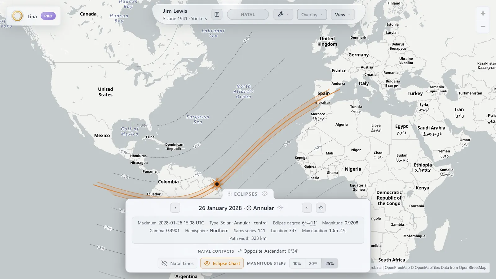
Solar eclipse paths and their magnitude contours drawn across the map, and the circles where a lunar eclipse is visible. Each eclipse carries its own details — type, magnitude, gamma, Saros series, lunation, degree, path width, phase durations — and a Natal Contacts list of what in your chart it touches within three degrees. Click a point on the map for that place's local contact times.
Activations
A dated list of when the running overlay's moving bodies — transiting, progressed or directed — stand exactly on your chart's four main angles, relocated to the place you're reading. Choose a window of three, six, twelve or twenty-four months, or five and ten years for the slower symbolic clocks, include the Moon or leave it out, and click any row to set the timeline to that moment. It is the answer to when, after the map has answered where.
Slide
Drag the world under your fixed natal lines and watch the sky turn. Nudge four minutes at a time, or an hour, or jump straight to the next rise, culmination or set at the active point. Parans stop being an abstraction the moment you see one planet reach the Midheaven exactly as another comes up over the horizon.
Sky Times
A band along the foot of the map giving the day's rise, culmination, set and anti-culmination times for every visible body at the active point, in that place's own local time. A table view lays it out as a speculum, and a time-stamp mode reads the sky at whatever spot you point at, marked by a glowing beacon that follows the cursor.
Paran Clock
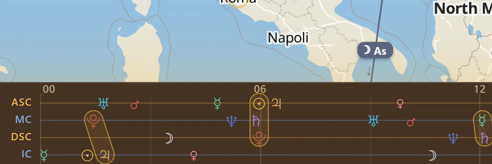
Expand the sky band and the day becomes a twenty-four hour track: every body's angle crossings plotted at their clock times, with the paran moments ringed where two of them coincide. Parans tell you where; this tells you when. With the Slide tool armed you can drag the track to scrub the day, or press an event to jump to it.
Chapter sixAsking the map questions
Discovery and Radar: two ways to stop reading the map line by line and let it answer instead.
Discovery
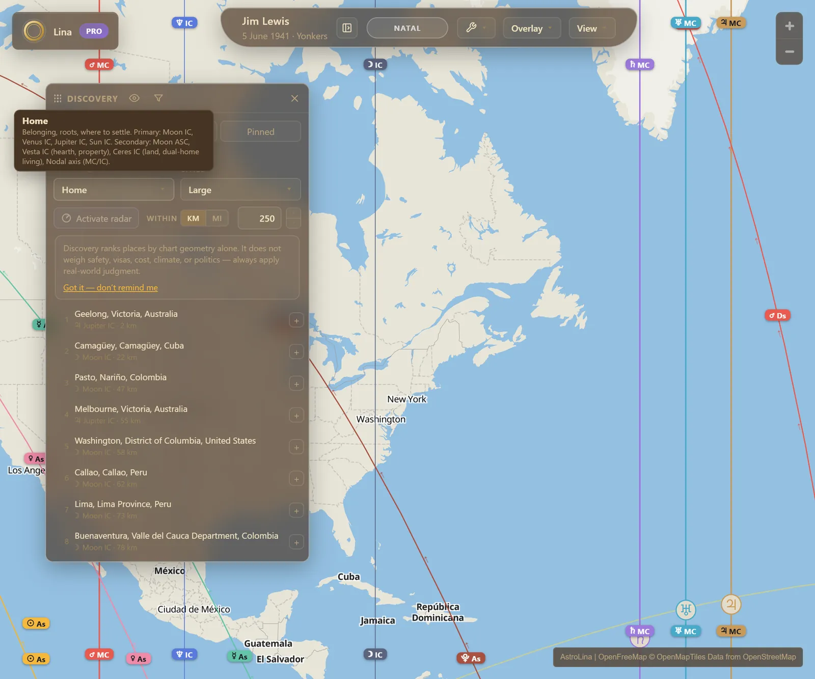
Rank the world's cities against a life theme instead of reading the map city by city. Ten themes ship — Love, Career, Prosperity, Home, Learning, Creativity, Vitality, Adventure, Spirit and Focus — and each is a curated set of primary and secondary lines, written by an astrologer rather than generated. Hover a theme and it shows you exactly which lines it is answering with. A city ranks by its single strongest theme line, never by adding scores together, and a neutral marker flags a demanding line running close to any recommendation.
Set the search radius, the minimum city size, and which countries to include or exclude. A theme ranking always reads the natal chart. One country never crowds a list, because the rest fold away behind a plus eleven more in Brazil.
Diffuse
A theme of its own, and the one that answers the opposite question: the places furthest from every planetary line at once. Jim Lewis called them zones of no influence, and they are as hard to find by eye as they are easy to find this way.
Search
Three ways to query rather than rank. Line composes a set with AND and NOT chips, each tested at its own class orb, for questions like Venus on the Ascendant but nowhere near Saturn. Planet lays one body's four angle lines out side by side. Paran lists the cities inside a latitude band, read west to east. Beside the mode sits the frame: search the natal chart, or any overlay at a date of your choosing, worked out without moving the map's own timeline.
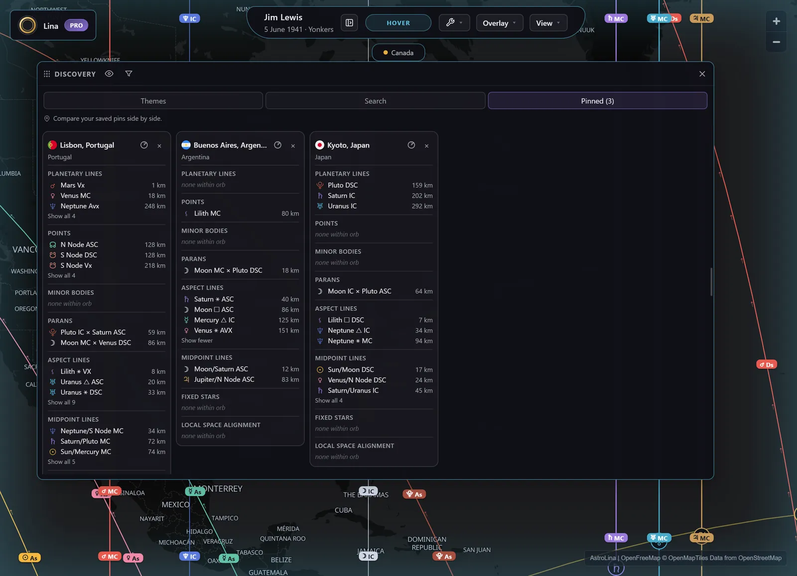
Pinned
Your shortlist, set against itself. Saved cities become cards side by side, each showing the same blocks in the same order — top lines per class, local-space alignment, the active frame — so comparing them is reading down a column rather than holding four maps in your head.
Radar
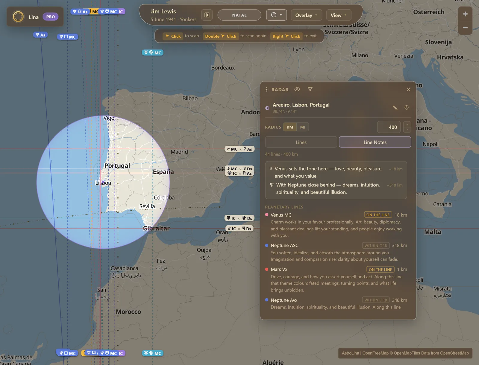
Sweep a circle over any place and the map dims to reveal every line passing near it — including the families you had switched off. Results come back grouped by class and ordered nearest first, each with its distance: planetary lines, points, minor bodies, parans, aspect lines, midpoint lines and fixed stars, each class with its own adjustable orb.
A second tab reads the same circle back to you as prose (see Line Notes), and a Local Space Alignment section compares the bearing from the birthplace, the pin or Home against every body's local-space direction. The scan pins itself and persists per chart, so coming back to a place tomorrow means opening it, not redoing it.
On what a ranking is. Discovery weighs geometry alone — not safety, not cost, not climate, not whether you would actually like living there. It is a way of asking better questions about places, not a verdict on them.
Chapter sevenFrom reading to deliverable
Journal, Reports and Capture — what survives the session.
Journal
Tag a spot on the map with a title, notes, an optional date and one of six tags — Pin, Notable, Favorite, Career, Difficult, Event — and it becomes a marker whose shape and colour say which. The date is optional on purpose: plenty of entries are about a place rather than a moment. Filter by text or by tag, click a marker to reopen the moment, or send it straight into a Radar scan. Entries belong to the chart and sync to your account.
Reports
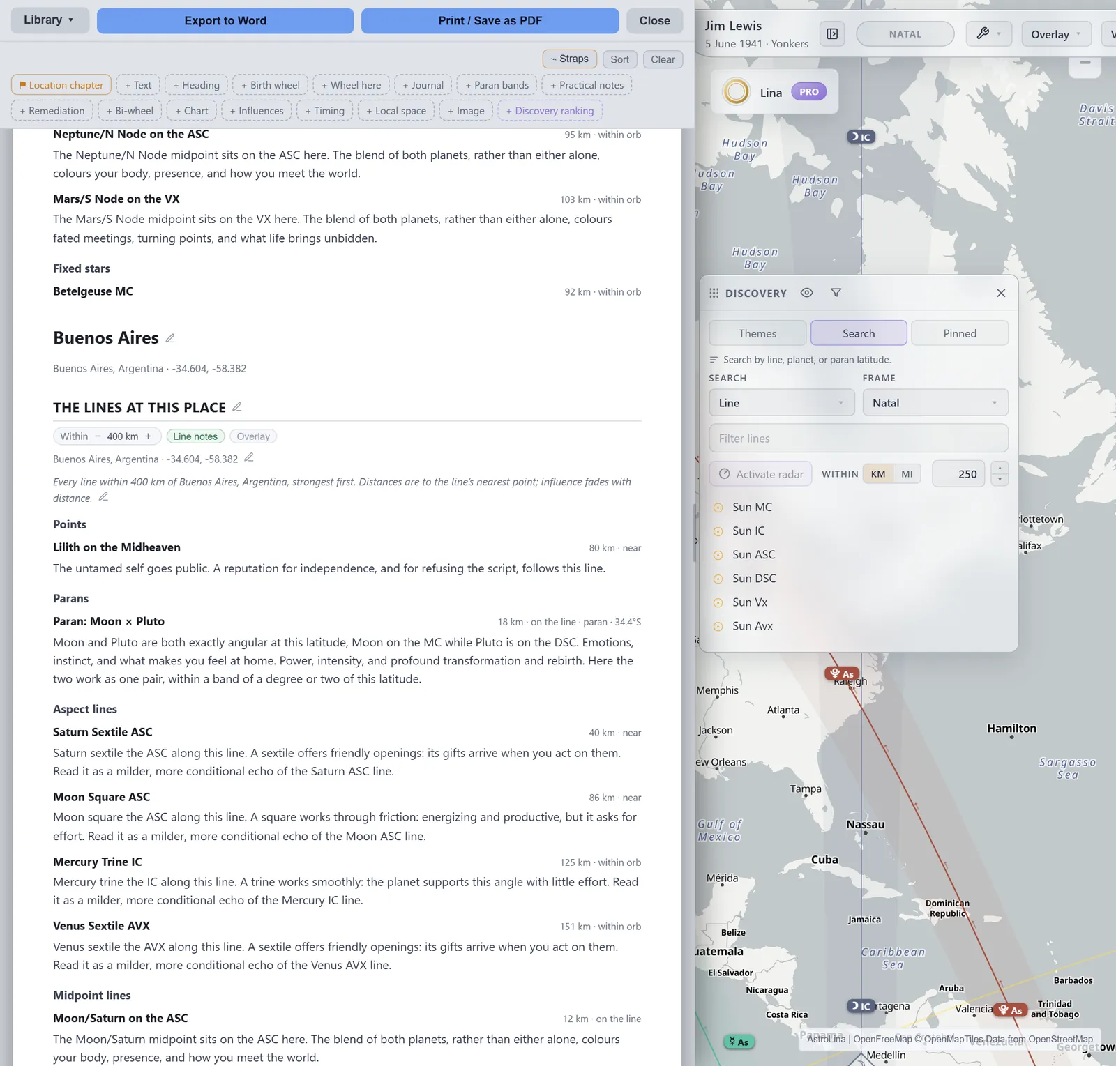
Compose in AstroLina, finish in your own editor. Location chapters, headings and free text, relocated charts and bi-wheels, influence lists, timing, paran bands, local space, practical notes, remediation, images, and live blocks fed by Discovery, Radar and the Journal — and every one of them carries its own place, so a single package can walk a client through several cities without ever inheriting the wrong one.
Every client-facing word is editable where it sits; empty a field and AstroLina's own wording comes back. Blocks drag by a grip or step with buttons, and a sort puts them into a suggested reading order. Five saved package slots sync to your account.
Export, and the preflight
Export to Word as a real .docx and it arrives fully editable — true heading styles, so Word's navigation pane and a generated table of contents both work, with native tables and images at print resolution. Your notes, your letterhead, your compass over a floor plan. Or print straight to PDF. Before it writes, a preflight screen lists the blocks with no place set, the blocks that found nothing, the repeated ones, and every block grouped under the place it describes, which is the wrong-city check. It also states the conventions the document is being rendered under: class orbs, zodiac, houses, node type, local-space origin. Nothing there blocks the export; export anyway is always available.
Capture to frame · to export
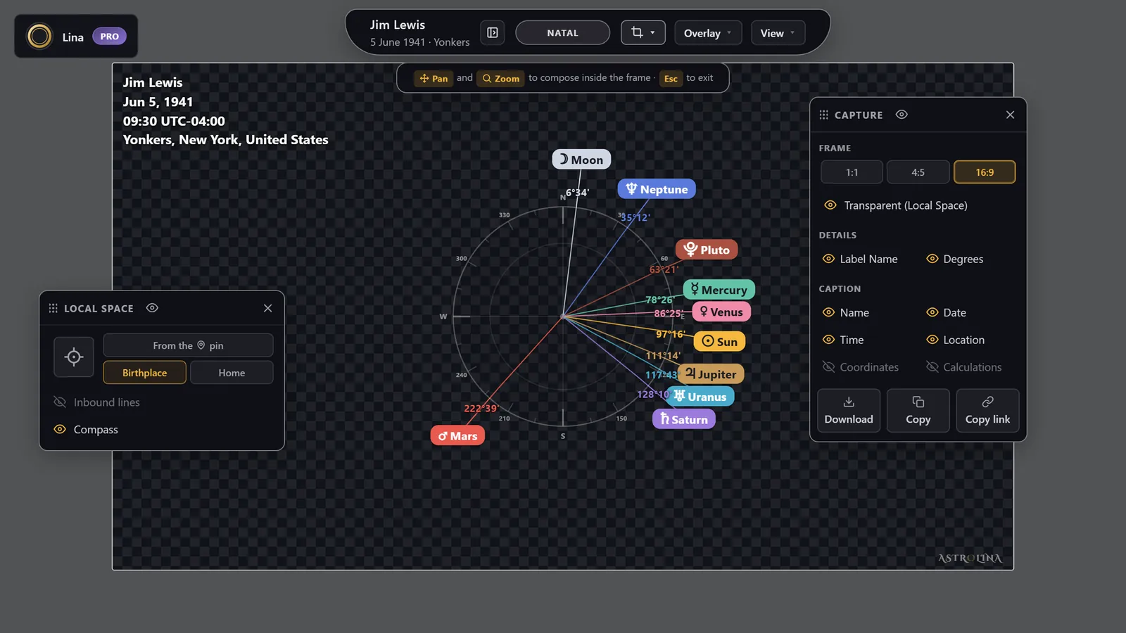
Frame the map and take a picture of it. Choose a square, portrait or widescreen ratio, pan and zoom to compose inside the frame, and add a details panel — the wheel, a list, the angles, the balance — with caption fields for name, date, time, location, coordinates and calculations, all following your pin. Then download it, copy it, hand it to the system share sheet, or copy a link that reopens the exact view.
Transparent (Local Space)
One switch in Capture's frame section hides the line arrows, moves the badges in to hug the frame edge, and blanks the basemap entirely, so the PNG comes out with a transparent background — the bearings clean, ready to lay over a floor plan, a site map or a photograph. Labels and degrees are separate toggles.
Add to report
With Reports open, Capture gains one more destination: the picture you have just framed goes into the document you are building, at print resolution, without a round trip through your downloads folder.
The paid toolkitWhat Pro adds
Everything above without a badge is free, and everything marked needs nothing more than an email and a six-digit code. Pro is the professional layer on top: Discovery, Radar, Reports, the Journal, Galaxy, the Local Space dials, the Paran Clock, Activations, Line Notes, the Aspects window, transparent capture, saved pins and street-level search.
Already subscribed and changing your mind? The unused part of what you paid comes off owning it, automatically, whichever way you pay.
Canadian customers are billed in Canadian dollars, at $19 a month$19 $17.10 for the first month, $149 a year$149 $134.10 for the first year, or $499 once$499 $449.10 once — or six payments of $83.17$83.17 $74.85. Prices are before tax; Canadian orders add GST or HST at checkout. Checkout is handled by Stripe, and you can cancel at any time.
Chapter eightUnder the hood
The engine, the data, the privacy model, and the app itself.
The engine
Positions come from the Swiss Ephemeris reading JPL DE441 data — the same lineage the professional desktop tools use — compiled to WebAssembly and running inside your browser. Nothing is computed on a server and sent back to you: the ephemeris is on your machine, which is why the map re-renders the instant you change a setting.
Frames and conventions
Two settings shape the linework, and they are not the same one. Projection draws a line In Mundo, from where the body physically stood, or In Zodiaco, from its position along the ecliptic. Line system is celestial, from the sky itself, or geodetic — a technique of its own, which pins 0° Aries to Greenwich, works tropically, and does not use the birth time at all. Everything else you can change — house system, zodiac, node type — recasts the wheel and leaves the map where it is.
Where a convention makes a feature meaningless the app says so rather than drawing something it cannot defend: parans go inert under Cyclocartography, because two epochs have no single sky-moment to share.
Places and time zones
Birthplaces resolve offline-first against a bundled city atlas with an online fallback, and time zones and their historical daylight saving come from the IANA database. That stack is excellent for dates after 1970 and for the Americas and Europe; for older dates elsewhere the historical record thins out, and such births are flagged as uncertain so you know to check. The sky turns fifteen degrees an hour, so four minutes of clock error moves a Midheaven line a full degree of longitude — which is why the birth time matters more than anything else you type.
Install it, and use it offline
AstroLina installs as an app — its own window, its own icon, edge to edge on a phone. The service worker caches the shell and the full ephemeris, and the bundled atlas answers place search without a connection, so a plane or a cabin is a perfectly good place to read a chart. If the map tiles cannot be reached, the map falls back to a plain world outline and every line still draws.
Privacy by default
Signed out, your birth details and charts never leave your browser — only the place lookups and the map tiles touch the network, as with any online map. Signed in, syncing your charts to your account is a switch you can turn off per device. There are no third-party trackers or analytics scripts anywhere — not on this site, not in the app.
Help centre
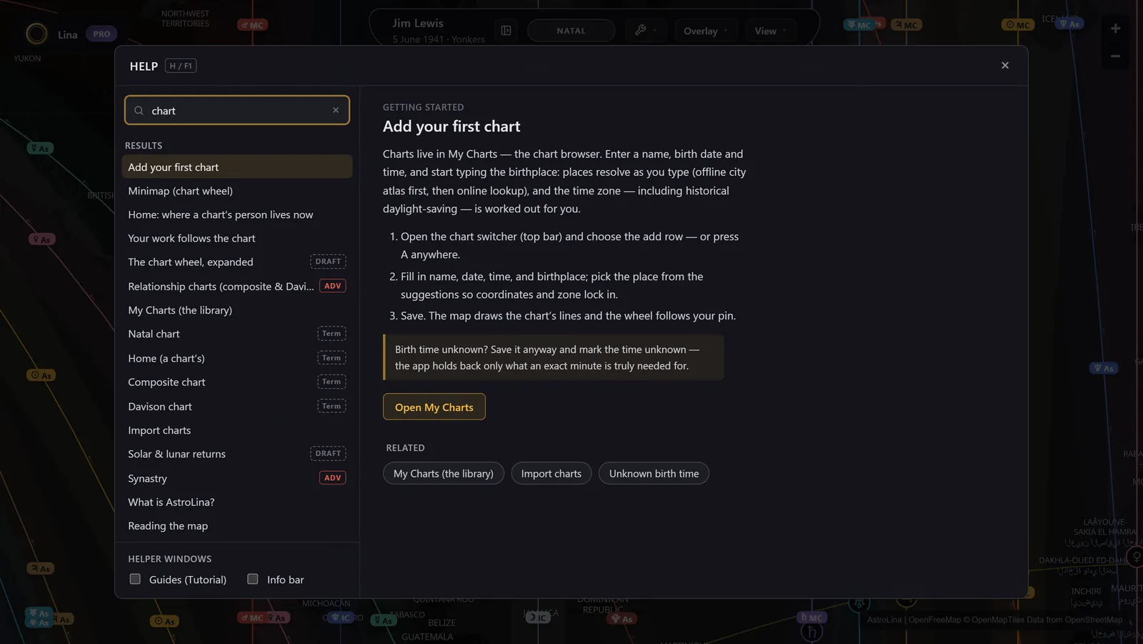
Sixty-odd articles across ten categories, a glossary of sixty-six terms from ayanamsa to speculum, fuzzy search over the lot, and a keyboard-shortcut sheet that reads itself from the app's own registries so it cannot drift. Most articles can open the thing they are explaining.
Open core
Everything above that is not marked is free and open-source software under the AGPL-3.0, and you can read the source. The Pro toolkit is proprietary and pays for the rest. Every data source, library and font is credited in full, with its licence, in the app's Credits dialog.
Start with your own chart
You have been living on this map since the moment you were born. Seeing it costs nothing, needs no account, and takes about a minute.
Open the map — it's free What is astrocartography?
Still working out the basics? The FAQ on our home page answers the questions we hear most, and the astrocartography guide walks through the four angles and what each planet means on them.